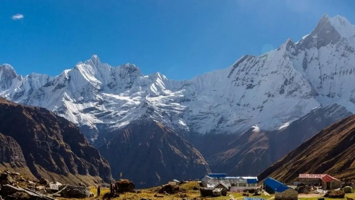
Spectacular view of Annapurna Base Camp surrounded by towering peaks
Annapurna Circuit Trek
Max Elevation
5,416 m at Thorong La Pass
Trip Duration
12-21 days
Trekking Distance
160-230 km
Bikepacking Distance
386 km (difficulty 8/10)
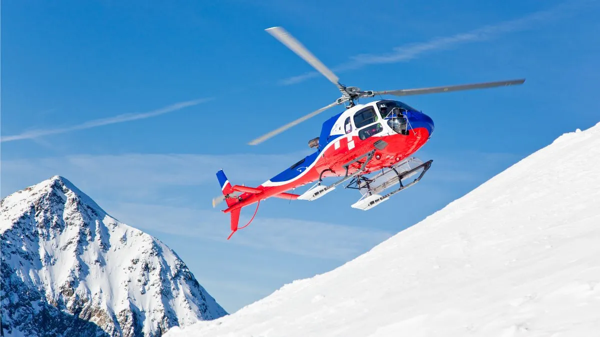
Helicopter Flight Time
40-60 minutes (e.g., Manang/Muktinath to & from Pokhara)
Best Seasons
Sept-Nov & Mar-May
Permits Required
ACAP + TIMS required; licensed guide mandatory for foreign trekkers in protected areas
TIMS Fees
NPR 2,000 (non-SAARC), NPR 1,000 (SAARC)
ACAP Fees
NPR 3,000 (non-SAARC), NPR 1,000 (SAARC)
Overview
The Annapurna Circuit trek takes you through all sorts of scenery, cultures, and weather. It kicks off in the Lamjung foothills with rice fields and waterfalls, then climbs through pine woods to the Thorong La Pass at 5,416 meters. Once you're past the pass, you're in the dry Mustang area, which is in the rain shadow of the Himalayas.
On the way, you will walk through villages with Gurung, Magar, Thakali, and Tibetan influences. You'll see monasteries, mani walls, and mountain views that keep changing as you go. Most hikers go around the circuit counterclockwise, so they can get used to the altitude gradually before tackling the pass.
Highlights of the Annapurna Circuit Trek
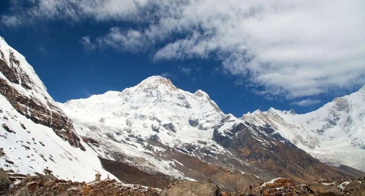
- Thorong La Pass (5,416 m): One of the highest trekking passes in the world. Offers views of Dhaulagiri (8,167 m), Annapurna I (8,091 m), and Manaslu (8,163 m).
- Tilicho Lake (4,919 m): High-altitude lake located below Tilicho Peak (7,134 m). Reached via a side trail from the main circuit through Khangsar and Yak Kharka.
- Muktinath Temple (3,800 m): Hindu and Buddhist pilgrimage site featuring 108 stone water spouts and a continuously burning natural gas flame.
- Manang (3,540 m): Acclimatization stop with access to short hikes offering views of Annapurna III (7,555 m), Gangapurna (7,455 m), and local glaciers.
- Kagbeni (2,800 m): Settlement with Tibetan-influenced architecture and a monastery dating to the 15th century. Entry checkpoint for the Upper Mustang region.
- Marpha (2,650 m): Thakali village known for apple farming, stone-paved lanes, and a monastery located on the hillside.
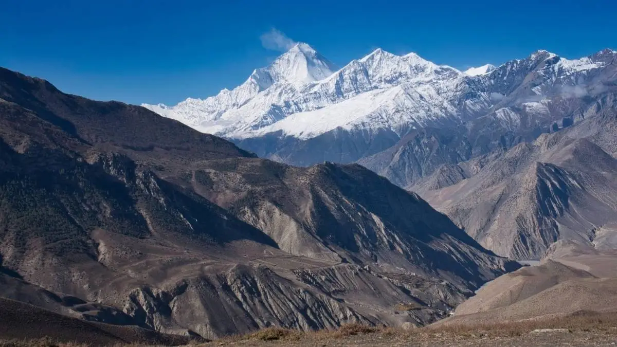
- Trail Terrain: The route includes subtropical valleys, pine and fir forests, high-altitude alpine zones, and semi-arid terrain in the rain shadow of the Annapurna Range.
- Cultural Regions: The route passes through areas inhabited by Gurung, Magar, and Thakali communities. Tibetan Buddhist elements are present in the upper Mustang and Manang areas.
- Kali Gandaki Gorge: A Section of the trail runs through the gorge located between the Annapurna and Dhaulagiri massifs.
- Route Options: Trek durations vary from around 7 to 21 days, depending on starting and ending points. Road access is available at multiple sections of the circuit, including Besisahar, Manang, Muktinath, Jomsom, and Tatopani.
Itinerary
Day 1: Hello Kathmandu!
1400mTouching down at Tribhuvan Airport is always a rush. You get a ride to the hotel, then chill out. Most people just unpack, double check their stuff, and take in the city vibes.
Day 2: Kathmandu's hot spots and Trek Talk
1400mKathmandu's always buzzing. A guide shows you around Pashupatinath, Boudhanath, and Patan Durbar Square, totally packed with history and people doing their thing. Later, your guide goes over the trek, what to expect, safety stuff, and the gear you'll need. It's a briefing and a hype session all in one.
Day 3: Road to Besisahar, Hike to Ngadi
930mThe drive to Besisahar is pretty, with rivers and fields all over the place. From there, you start trekking through villages and farmland near the Marsyangdi River. Ngadi is a chill spot by the river with lodges, like you're way out of the city.
Day 4: Hike to Jagat
1310mToday's an easy warm-up. You cross bridges over the Marsyangdi, walk through forests and farms, and stop in little towns. Jagat is a stone village with a Tibetan feel, prayer flags everywhere.
Day 5: Hike to Pisang
3200mNow the climb gets real. Pine forests line the trail as you go up. Around noon, you start seeing Annapurna II and Lamjung Himal, stunning! Pisang is high up with great mountain views, comfy lodges, and a place to chill.
Day 6: Hike to Ngawal
3660mThe trail to Ghyaru is harder, worth it with views of the mountains and the Marsyangdi Valley. Ngawal is a quiet Tibetan town with stone houses and monastery great for soaking in the culture.
Day 7: Hike to Manang
3540mIt's a shorter day, but the altitude kicks in. The area gets dry, with Buddhist shrines and prayer walls all around. Manang is bigger than the other villages, with guesthouses, bakeries, and a small town in the mountains.
Day 8: Getting Used to Manang
3540mTake it easy today. Hike to Gangapurna Lake or Ice Lake for killer mountain views. Check out monasteries or go to an altitude talk. Just let your body get used to the height while checking out town.
Day 9: Hike to Yak Kharka
4050mToday is all about meadows and yaks. Watch for blue sheep or birds. Yak Kharka is small, with lodges that make you slow down. The altitude and scenery make you appreciate every step.
Day 10: Hike to Thorong Phedi
4500mThe trail is rocky and steep. Even pros feel the altitude. Thorong Phedi, at the base of the pass, has simple lodges. It's calm, with folks getting ready for tomorrow's big climb.
Day 11: Cross Thorong La Pass, Hike to Muktinath
3760mRise and shine! The climb to Thorong La Pass is slow but amazing. The top has views of Annapurna and Dhaulagiri. Going down to Muktinath is long but peaceful. Temples, monasteries, and knowing you made it, worth it.
Day 12: Drive to Tatopani
1200mFrom Mustang's desert to the Kali Gandaki Valley, the landscape changes a lot. Tatopani has hot springs where you can chill and relax.
Day 13: Hike to Ghorepani
2850mThe trail climbs through farms and forests. Ghorepani is popular, with great views and a cozy feel after a long day.
Day 14: Poon Hill Sunrise, Hike to Tadapani
2630mWake up early for the sunrise view of Annapurna and Dhaulagiri from Poon Hill. After breakfast, you hike through forests, going up and down to Tadapani.
Day 15: Hike to Ghandruk
1940mThe trail goes down through forests and fields to Ghandruk, one of the biggest Gurung villages. See homes, a museum, and views of Annapurna South and Machapuchare.
Day 16: Drive to Pokhara
822mThe trek's over with a ride from Nayapul to Pokhara. The city by Phewa Lake has places to relax after the hike. Spend the afternoon exploring or chilling.
Day 17: Pokhara
822mCheck out Pokhara, boat on Phewa Lake, visit Peace Pagoda, Davis Falls and Gupteshwor Cave, or paraglide. Just chill and think about the trek.
Day 18: Back to Kathmandu
1400mGo back to Kathmandu by road or plane. A lot of people have a farewell dinner to celebrate finishing the Annapurna Circuit.
Cost Breakdown
| Item | Budget Price | Mid Range Price | Luxury Price |
|---|---|---|---|
| Permits (ACAP + TIMS) | $25-35 | $25-35 | $25-35 |
| Guide (per day) | $25 | $35 | $50+ |
| Porter (per day) | $20 | $25 | $35 |
| Stay & Meals (per day) | $20 | $40 | $80+ |
| Extras (transport/gear/heli add-ons) | $200-300 | $300-500 | $800+ |
Note: TIMS and ACAP are priced in NPR and fluctuate slightly in USD; current references show TIMS NPR 2,000/1,000 (non-SAARC/SAARC) and ACAP NPR 3,000/1,000 (non-SAARC/SAARC).
Trip Map
No map available
Compliance
Permits: ACAP + TIMS Required
ACAP + TIMS required; permits can now be applied for/processed online or via agency (ACAP e-permit is live; TIMS is handled through NTB/agency).
Guide Rule
Since Apr 1, 2023, foreign trekkers in protected areas must trek with a licensed guide; it applies to cyclists too.
Altitude & Weather
Build acclimatization days; winter storms and monsoon hazards require flexibility and local advice. The weather can be unpredictable.
Insurance
Comprehensive insurance, including helicopter evacuation, is strongly recommended. (Most operators require it.)
Emergency Evac & Heli
Helicopters operate year-round, weather permitting; typical Manang/Muktinath ↔ Pokhara segments run 40-60 minutes.
Packing
Fitness Preparation
Cardio base, hill repeats, and back-to-back long hikes help; practice with a loaded pack and, for cyclists, hike-a-bike at altitude.
Essential Gear
Trekking boots - Waterproof, broken-in, ankle support essential
Layering system - Base layers, insulating layers, and outer shell
Down jacket - For warmth at higher altitudes
Rain shell - Waterproof and windproof protection
Sleeping bag (-10°C) - Or rent in Kathmandu/Pokhara
Trekking poles - Essential for stability and knee protection
Hat - Warm hat/beanie for cold conditions
Gloves - Insulated and waterproof recommended
Sunglasses - UV protection, essential for snow glare
SPF sunscreen - High altitude UV protection
Headlamp - LED with extra batteries
Water treatment - Tablets or filter for safe drinking water
Power bank - High capacity for device charging
Personal first-aid kit - With altitude medications as advised by your clinician
For Cyclists: Bring robust tubeless tires, brake pads, and a derailleur hanger; expect long pushing sections and possible ice/snow near the pass.
Connectivity, Money & Practicalities
Cash & ATMs: Carry sufficient NPR; ATMs are limited/unreliable beyond gateway towns (e.g., Jomsom sometimes, not guaranteed). Expect to pay cash for rooms, meals, charging, and Wi-Fi.
Wi-Fi & Power: Many teahouses offer paid Wi-Fi and device charging; bring a high-capacity power bank.
Road Access: Ongoing road links allow jeep transfers to shorten or reroute days; this also enables bike shuttles.
SIM & Coverage: NTC/Ncell works mostly; don't rely on continuous data. (Buy a local SIM in Kathmandu/Pokhara before departure.)
Water & Waste: Use bottle-refill stations where available, purify all water to reduce plastic.
Additional Recommended Items
Trekking pants - Quick-dry, comfortable for long walks
Hiking socks - Merino wool, bring 4-5 pairs
Camp shoes - Light sandals or slip-ons for teahouses
Backpack (40-50L) - Comfortable, quality pack with rain cover
Water bottles - 2-3 liters capacity
Lip balm with SPF - Prevention against chapping
Quick-dry towel - Compact and lightweight
Plastic bags/dry bags - Keep gear dry
Energy bars and snacks - High-calorie trail food
Important Notes
Altitude: The trek reaches 5,416m at Thorong La Pass. Proper acclimatization and gear are crucial for safety.
Weather: Weather can change rapidly. Be prepared for rain, snow, and extreme cold.
Permits: ACAP permit and TIMS card required.
Travel Insurance: Must cover high altitude trekking up to 6,000m.
Frequently Asked Questions
Find answers to common questions about our trips
Related Trekking
Annapurna Helicopter Tour
Experience breathtaking aerial views of the Annapurna range on this scenic helicopter tour over the majestic Himalayas.
Explore →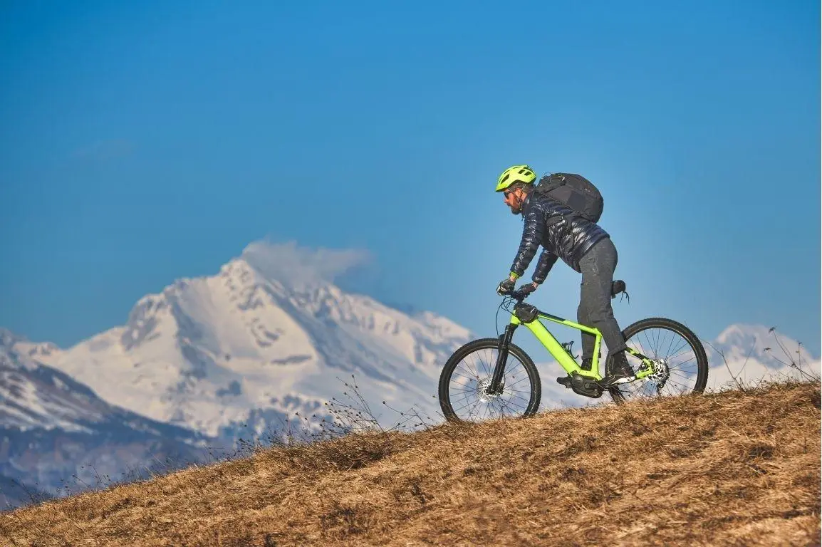
Annapurna Motorbike Adventure
Ride through stunning mountain roads and villages on an adventurous motorbike journey around the Annapurna region.
Explore →