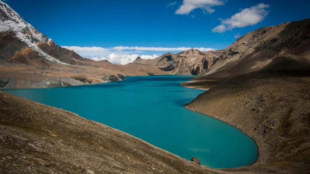
Beautiful view of Tilicho Lake
Manang Trek
Elevation (Town of Manang)
3,519 m
Trip Duration (Trek from Manang to Muktinath via Thorong La)
Typically 7 - 9 days
Trekking Distance (Manang to Thorong La to Muktinath)
33 km
Max Elevation Nearby
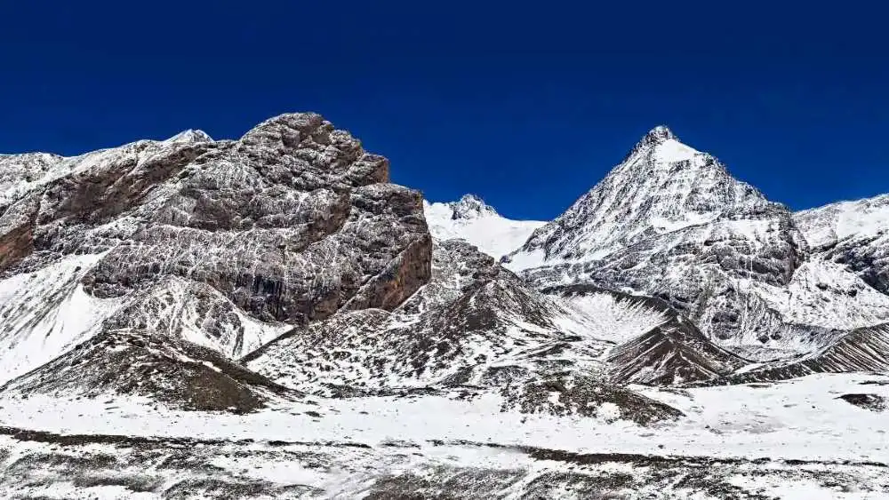
5,416 m Thorong La Pass
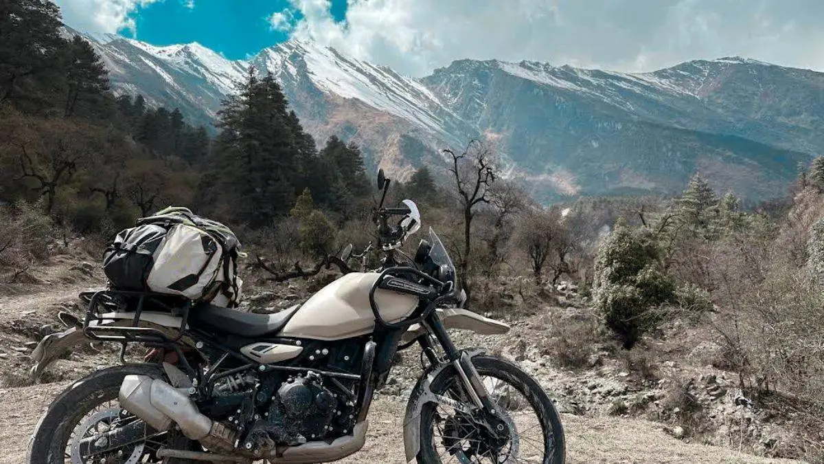
Bikepacking Difficulty
Thorong La at 5,416 m
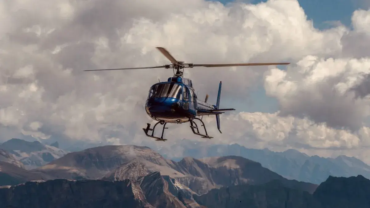
Helicopter Flight Time
20 minutes
Best Seasons
March - May (Spring) and September - November (Autumn)
Permits Required
ACAP Permit, TIMS Card, Licensed Guide
ACAP Permit (Annapurna Conservation Area)
NPR 3,000 for foreigners; NPR 1,000 for SAARC nationals
TIMS Card
NPR 2,000 for foreign individual trekkers; NPR 1,000 (or NPR 600) for SAARC nationals
Overview
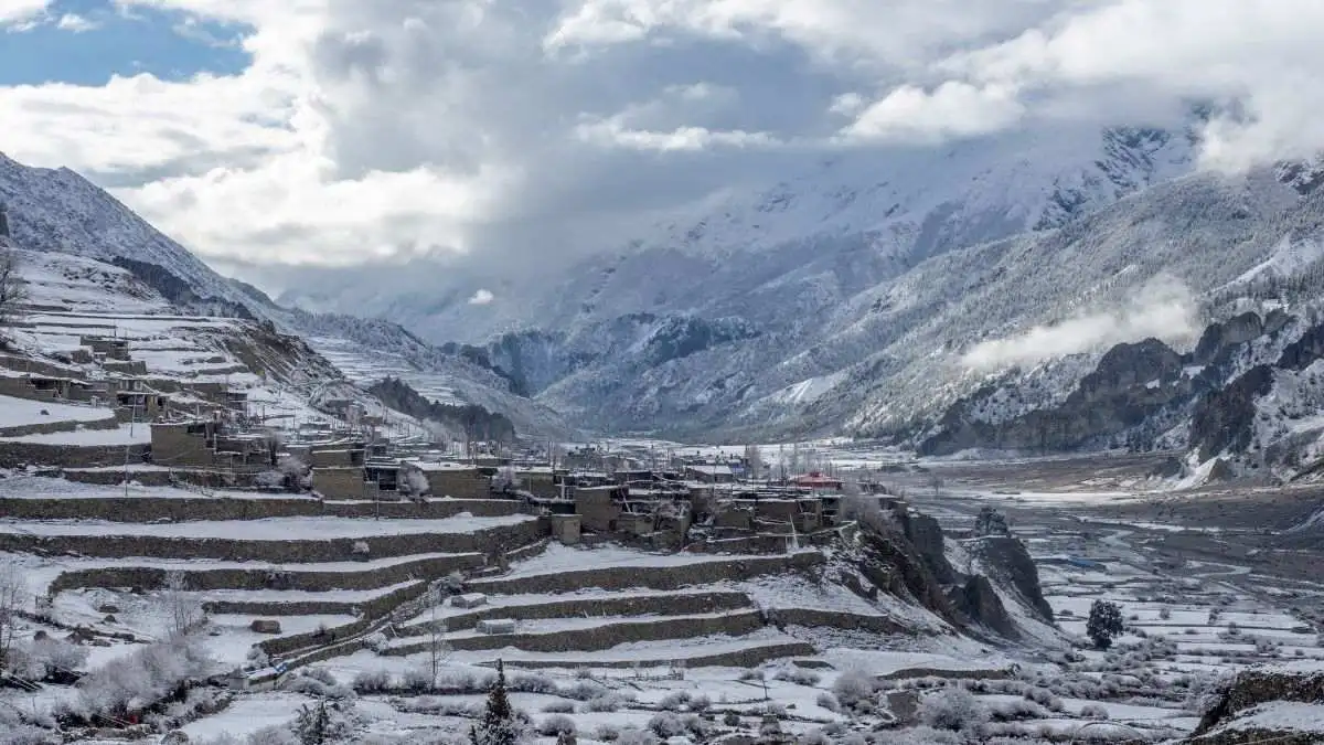
Manang stands as a serene high-altitude oasis nestled at about 3,519 m, perched between towering peaks of the Annapurna Massif and the Chulu range. Its unique position makes it essential, both biologically and spiritually, as you journey deeper into the Himalayas.
Here, in stone-walled lodges warmed by stoves, trekkers acclimatize while surrounded by cultural richness, from fluttering prayer flags to mirrored glacial lakes. Manang isn’t just a stopover; it’s where your trek shifts into its most pivotal phase: gaining altitude safely, absorbing culture, and forging ahead with renewed strength and clarity.
Highlights of the Manang Trek
Manang (3,540 m): High-altitude village surrounded by peaks like Annapurna III (7,555 m), Gangapurna (7,455 m), and Tilicho Peak (7,134 m). Serves as a key acclimatization hub for trekkers heading toward Thorong La.
Gangapurna Lake & Glacier Viewpoint: Short hike from Manang leads to a glacial lake and panoramic views of Gangapurna and surrounding ridgelines.
Ice Lake (Kicho Tal, 4,620 m): A challenging acclimatization day hike offering sweeping vistas of the Annapurna Range, Tilicho Peak, and Chulu peaks.
Tilicho Lake Side Trek (4,919 m): Optional detour via Khangsar and Siri Kharka to one of the highest lakes in the world, set beneath the sheer slopes of Tilicho Peak.
Bhojo Gompa & Praken Gompa: Ancient cliffside monasteries above Manang where local monks offer blessings for a safe crossing of Thorong La.
Braga (3,470 m): Traditional village with a centuries-old Tibetan Buddhist monastery perched on a rock face, offering cultural insight and mountain views.
Khangsar Village (3,734 m): Traditional stone village en route to Tilicho Lake, preserving Tibetan Buddhist culture and architecture.
Flora & Fauna: The trail passes through pine forests, alpine meadows, and high-altitude landscapes, home to blue sheep, Himalayan griffons, and snow leopards (rare).
Cultural Landscape: Region inhabited by Manangi people, known for their Tibetan Buddhist heritage, yak herding, and trade history along ancient salt routes.
Itinerary
Day 1: Pokhara to Besisahar to Ngadi
1000mDrive from Pokhara to Besisahar. Then a short trek to Ngadi and enter Annapurna Conservation Area.
Day 2: Ngadi to Chame to Pisang
3250mEarly morning drive to Chame via jeep (scenic but bumpy). Gentle trek to Pisang village with overnight stay.
Day 3: Pisang to Manang
3519mTrek into Manang. Settle in and take a short acclimatization walk.
Day 4: Manang (Acclimatization Day)
3519mHike to Ice Lake (Kicho Tal). Return to Manang and rest.
Day 6: Manang to Braga to Milarepa Cave to Manang
3519mMorning visit to historic Braga Monastery. Afternoon hike to Milarepa Cave and return to Manang by evening.
Day 7: Manang (Optional Hike)
3519mOptional morning hike to Gangapurna Lake. Afternoon cultural immersion or rest.
Day 8: Manang to Chame to Pokhara
882mBegin early return trek to Chame. Continue by jeep to Pokhara for an evening arrival.
Cost Breakdown
| Item | Budget Price | Mid Range Price | Luxury Price |
|---|---|---|---|
| Accommodation (per night) | $5 to $12 | $20 to $40 | $60 to $120+ |
| Gear rental (per day) | $2 to $5 | $6 to $10 | $12 to $20 |
| Wi-Fi or charging | $1 to $3 | $4 to $8 | Fast wifi included in lodging |
| Meals (per day) | $10 to $20 | $25 to $35 | $40 to $60+ |
| Guide (per day) | $25 to $35 | $40 to $60 | $80 to $150+ |
| Porter (per day) | $18 to $25 | $25 to $35 | $40 to $60 |
Note: 1. ACAP Permit - NPR 3,000 (foreigners) & NPR 1,000 (SAARC nationals) 2. TIMS Card - NPR 2,000 (foreigners) & NPR 1,000 (SAARC nationals)
* All prices are in USD
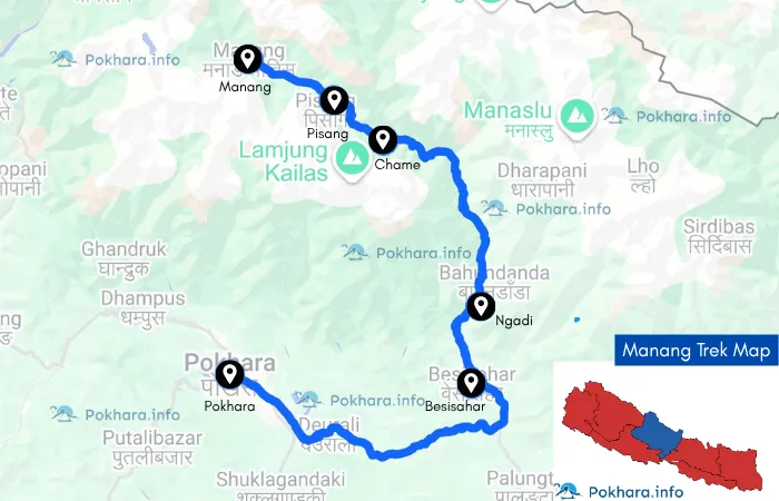
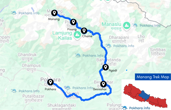
Trip Map
Compliance
Permits Required
Same as the main circuit, ACAP + TIMS required; carry both on your journey.
Guide Regulation
Foreign hikers in the region must trek with a licensed guide (enforced since April 1, 2023).
Altitude Risk
Manang helps significantly reduce acute altitude sickness risk—but make use of acclimatization hikes and stay hydrated.
Medical Aid
The Himalayan Rescue Association clinic offers altitude medicine, oxygen, and first aid.
Packing
Fitness: Build cardiovascular endurance; prepare for high-altitude activities with steep acclimatization walks.
Essential Gear
Layered clothing, down jacket, gloves, hat, and sun protection.
Trekking boots, poles, headlamp, power bank, water treatment pills.
Small daypack if you’re adding side-hikes.
Connectivity, Money & Practicalities (Added for you)
Cash & ATMs: Carry sufficient NPR; ATMs are limited/unreliable beyond gateway towns (e.g., Jomsom sometimes, not guaranteed). Expect to pay cash for rooms, meals, charging, and Wi-Fi.
Wi-Fi & Power: Many teahouses offer paid Wi-Fi and device charging; bring a high-capacity power bank.
Road Access: Ongoing road links allow jeep transfers to shorten or reroute days; this also enables bike shuttles.
SIM & Coverage: NTC/Ncell works mostly; don’t rely on continuous data. (Buy a local SIM in Kathmandu/Pokhara before departure.)
Water & Waste: Use bottle-refill stations where available, purify all water to reduce plastic.
Frequently Asked Questions
Find answers to common questions about our trips